
Morrow County topographic map
Interactive map
Click on the map to display elevation.
About this map
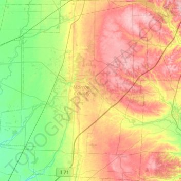
Name: Morrow County topographic map, elevation, terrain.
Location: Morrow County, Ohio, Vereinigte Staaten von Amerika (40.34512 -83.02197 40.71270 -82.62330)
Average elevation: 352 m
Minimum elevation: 277 m
Maximum elevation: 453 m