
Oak Island topographic map
Interactive map
Click on the map to display elevation.
About this map
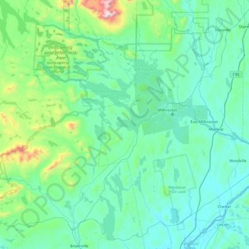
Name: Oak Island topographic map, elevation, terrain.
Average elevation: 229 m
Minimum elevation: 46 m
Maximum elevation: 1,579 m
Other topographic maps
Click on a map to view its topography, its elevation and its terrain.
Piscataquis County
United States of America > Maine
Piscataquis County, Maine, United States of America
Average elevation: 310 m