
Kadus topographic map
Interactive map
Click on the map to display elevation.
About this map
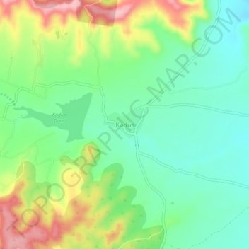
Name: Kadus topographic map, elevation, terrain.
Location: Kadus, Khed, Maharashtra, 412404, India (18.87454 73.79270 18.91454 73.83270)
Average elevation: 667 m
Minimum elevation: 609 m
Maximum elevation: 770 m
Other topographic maps
Click on a map to view its topography, its elevation and its terrain.