
Ihme topographic map
Interactive map
Click on the map to display elevation.
About this map
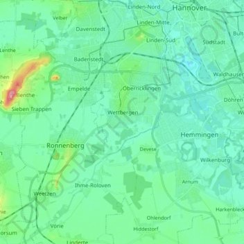
Name: Ihme topographic map, elevation, terrain.
Location: Ihme, Hanôver, Region Hannover, Baixa Saxônia, 30449, Alemanha (52.27509 9.62124 52.37752 9.73624)
Average elevation: 65 m
Minimum elevation: 43 m
Maximum elevation: 168 m