
Thank you for supporting this site ❤️
Make a donation
Make a donation
Noblesville topographic map
Click on the map to display elevation.
Thank you for supporting this site ❤️
Make a donation
Make a donation
About this map
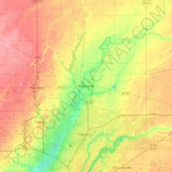
Name: Noblesville topographic map, elevation, terrain.
Location: Noblesville, Hamilton County, Indiana, 46060, United States (39.88559 -86.16860 40.20559 -85.84860)
Average elevation: 258 m
Minimum elevation: 216 m
Maximum elevation: 295 m
Thank you for supporting this site ❤️
Make a donation
Make a donation