
Weizberg topographic map
Interactive map
Click on the map to display elevation.
About this map
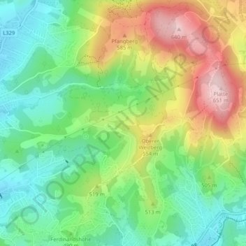
Name: Weizberg topographic map, elevation, terrain.
Location: Weizberg, Andritz, Graz, Steiermark, 8043, Österreich (47.09879 15.44396 47.11879 15.46396)
Average elevation: 485 m
Minimum elevation: 384 m
Maximum elevation: 643 m
Other topographic maps
Click on a map to view its topography, its elevation and its terrain.
Waltendorf
Österreich > Steiermark > Graz
Der Bezirk liegt im Osten der Stadt auf dem Höhenrücken zwischen Ragnitz- und Peterstal, aus welchem die Kuppen des Ruckerlberg und des Lustbühel hervorragen.
Average elevation: 401 m