
Thank you for supporting this site ❤️
Make a donation
Make a donation
Setif topographic map
Click on the map to display elevation.
Thank you for supporting this site ❤️
Make a donation
Make a donation
Setif
Sétif (Arabic: سطيف, Berber languages: Sṭif) is the capital of the Sétif Province in Algeria. It is one of the most important cities of eastern Algeria and the country as a whole, since it is considered the trade capital of the country. It is an inner city, situated in the eastern side of Algeria, at 270 kilometers east of Algiers, at 131 km west of Constantine, in the Hautes Plaines region south of Béjaia and Jijel. The city is at 1,100 meters of altitude.
Thank you for supporting this site ❤️
Make a donation
Make a donation
About this map
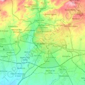
Name: Setif topographic map, elevation, terrain.
Location: Setif, Setif District, Setif, 19000, Algeria (36.13356 5.33706 36.24869 5.50629)
Average elevation: 1,064 m
Minimum elevation: 937 m
Maximum elevation: 1,319 m
Thank you for supporting this site ❤️
Make a donation
Make a donation