
Beesands topographic map
Click on the map to display elevation.
About this map
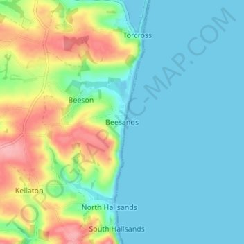
Name: Beesands topographic map, elevation, terrain.
Location: Beesands, South Hams, Devon, England, TQ7 2EL, United Kingdom (50.23187 -3.67750 50.27187 -3.63750)
Average elevation: 32 m
Minimum elevation: -5 m
Maximum elevation: 118 m