
Sotres topographic map
Interactive map
Click on the map to display elevation.
About this map
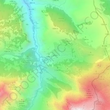
Name: Sotres topographic map, elevation, terrain.
Location: Sotres, Cabrales, Asturies, Espagne (43.21308 -4.76922 43.25308 -4.72922)
Average elevation: 1,237 m
Minimum elevation: 720 m
Maximum elevation: 2,048 m