
Borg topographic map
Interactive map
Click on the map to display elevation.
About this map
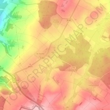
Name: Borg topographic map, elevation, terrain.
Location: Borg, Perl, Landkreis Merzig-Wadern, Saarland, Deutschland (49.47544 6.40500 49.51408 6.46031)
Average elevation: 365 m
Minimum elevation: 242 m
Maximum elevation: 430 m
Other topographic maps
Click on a map to view its topography, its elevation and its terrain.
Villa Borg
Deutschland > Saarland > Landkreis Merzig-Wadern > Borg
Villa Borg, Im Meeswald, Borg, Perl, Landkreis Merzig-Wadern, Saarland, 66706, Deutschland
Average elevation: 370 m
Pillinger Hof
Deutschland > Saarland > Landkreis Merzig-Wadern > Borg > Pillinger Hof
Pillinger Hof, Borg, Perl, Landkreis Merzig-Wadern, Saarland, 66706, Deutschland
Average elevation: 317 m