
Jwalamukhi topographic map
Interactive map
Click on the map to display elevation.
About this map
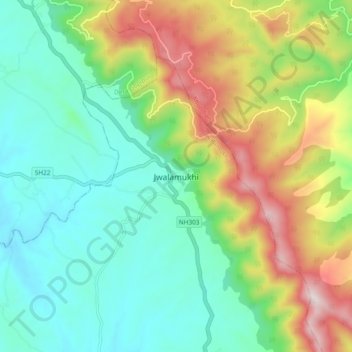
Name: Jwalamukhi topographic map, elevation, terrain.
Location: Jwalamukhi, Kangra, Himachal Pradesh, India (31.83408 76.28094 31.91408 76.36094)
Average elevation: 665 m
Minimum elevation: 437 m
Maximum elevation: 1,133 m