
Mayabunder topographic map
Interactive map
Click on the map to display elevation.
About this map
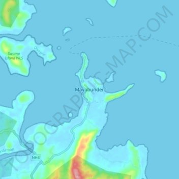
Name: Mayabunder topographic map, elevation, terrain.
Location: Mayabunder, Andaman and Nicobar Islands, India (12.87002 92.86145 12.95002 92.94145)
Average elevation: 8 m
Minimum elevation: -3 m
Maximum elevation: 168 m