
Woodbridge topographic map
Interactive map
Click on the map to display elevation.
About this map
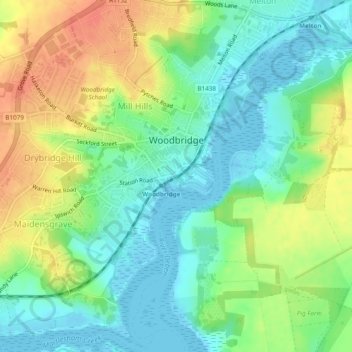
Name: Woodbridge topographic map, elevation, terrain.
Location: Woodbridge, East Suffolk, Suffolk, Angleterre, Royaume-Uni (52.07640 1.28439 52.10577 1.32901)
Average elevation: 19 m
Minimum elevation: -5 m
Maximum elevation: 46 m
Other topographic maps
Click on a map to view its topography, its elevation and its terrain.
Charsfield
Royaume-Uni > Angleterre > Suffolk > East Suffolk
Charsfield, East Suffolk, Suffolk, Angleterre, Royaume-Uni
Average elevation: 44 m