
Niendorf topographic map
Interactive map
Click on the map to display elevation.
About this map
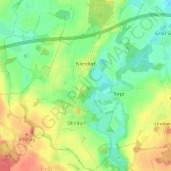
Name: Niendorf topographic map, elevation, terrain.
Average elevation: 30 m
Minimum elevation: 7 m
Maximum elevation: 61 m
Niendorf liegt am Flüsschen Maurine, ca. 13 km südöstlich von Lübeck. Das hügelige Gebiet um den Ort erreicht Höhen bis zu 50 m ü. NN.