
Uitikon topographic map
Interactive map
Click on the map to display elevation.
About this map
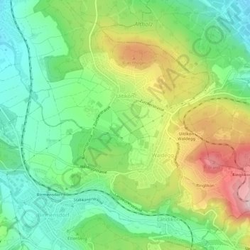
Name: Uitikon topographic map, elevation, terrain.
Location: Uitikon, Bezirk Dietikon, Zürich, 8142, Schweiz (47.35268 8.43541 47.38025 8.48728)
Average elevation: 542 m
Minimum elevation: 429 m
Maximum elevation: 731 m
Uitikon setzt sich aus den Teilen Ringlikon, Waldegg und Uitikon zusammen. Ringlikon war bis 1917 eine eigene Zivilgemeinde. Die topographisch bedingte Dreiteilung wird noch unterstützt durch die Strasse über die Waldegg. Diese Ausfallstrasse aus Zürich ist eine der am stärksten befahrenen Hauptverkehrsstrassen auf Kantonsgebiet.