
Stilfs - Stelvio topographic map
Interactive map
Click on the map to display elevation.
About this map
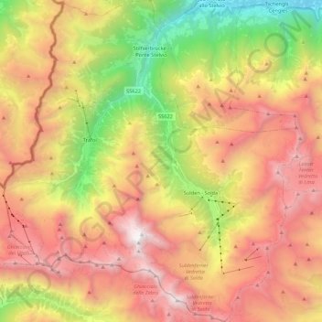
Name: Stilfs - Stelvio topographic map, elevation, terrain.
Average elevation: 2,419 m
Minimum elevation: 863 m
Maximum elevation: 3,867 m
Other topographic maps
Click on a map to view its topography, its elevation and its terrain.
Monte Zebrù
Italië > Trento-Zuid-Tirol > Stilfs - Stelvio
Monte Zebrù, Stilfs - Stelvio, Vinschgau - Val Venosta, BZ, Trento-Zuid-Tirol, Italië
Average elevation: 3,192 m
Vertainspitze - Cima Vertana
Italië > Trento-Zuid-Tirol > Stilfs - Stelvio
Vertainspitze - Cima Vertana, Stilfs - Stelvio, Vinschgau - Val Venosta, BZ, Trento-Zuid-Tirol, Italië
Average elevation: 3,055 m