
Thank you for supporting this site ❤️
Make a donation
Make a donation
Waite Hill topographic map
Click on the map to display elevation.
Thank you for supporting this site ❤️
Make a donation
Make a donation
About this map
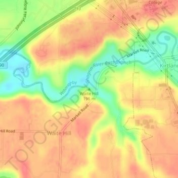
Name: Waite Hill topographic map, elevation, terrain.
Location: Waite Hill, Lake County, Ohio, 44094, United States (41.62528 -81.37794 41.62538 -81.37784)
Average elevation: 225 m
Minimum elevation: 187 m
Maximum elevation: 246 m
Thank you for supporting this site ❤️
Make a donation
Make a donation