
Thank you for supporting this site ❤️
Make a donation
Make a donation
Viswema topographic map
Click on the map to display elevation.
Thank you for supporting this site ❤️
Make a donation
Make a donation
About this map
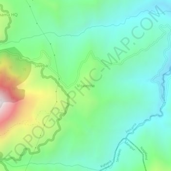
Name: Viswema topographic map, elevation, terrain.
Location: Viswema, Jakhama, Kohima, Nagaland, 797005, India (25.54397 94.12659 25.58397 94.16659)
Average elevation: 1,530 m
Minimum elevation: 1,190 m
Maximum elevation: 2,413 m
Thank you for supporting this site ❤️
Make a donation
Make a donation