
Geigant topographic map
Interactive map
Click on the map to display elevation.
About this map
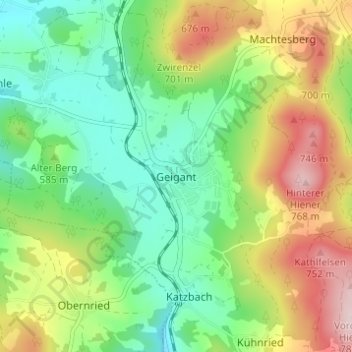
Name: Geigant topographic map, elevation, terrain.
Average elevation: 582 m
Minimum elevation: 468 m
Maximum elevation: 772 m
Other topographic maps
Click on a map to view its topography, its elevation and its terrain.
Perlhütte
Deutschland > Bayern > Landkreis Cham > Waldmünchen
Perlhütte, Waldmünchen, Landkreis Cham, Bayern, 93449, Deutschland
Average elevation: 583 m
Spielberg
Deutschland > Bayern > Landkreis Cham > Waldmünchen
Spielberg, Waldmünchen, Landkreis Cham, Bayern, 93492, Deutschland
Average elevation: 578 m