
Ramasse topographic map
Interactive map
Click on the map to display elevation.
About this map
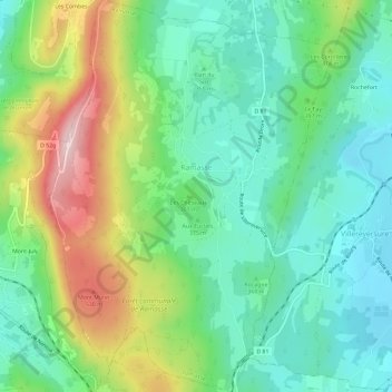
Name: Ramasse topographic map, elevation, terrain.
Average elevation: 380 m
Minimum elevation: 280 m
Maximum elevation: 589 m
Other topographic maps
Click on a map to view its topography, its elevation and its terrain.
Culoz
Frankreich > Auvergne-Rhone-Alpen > Ain > Culoz
Culoz, Belley, Ain, Auvergne-Rhone-Alpen, Metropolitanes Frankreich, 01350, Frankreich
Average elevation: 449 m