
Thank you for supporting this site ❤️
Make a donation
Make a donation
Høng topographic map
Click on the map to display elevation.
Thank you for supporting this site ❤️
Make a donation
Make a donation
About this map
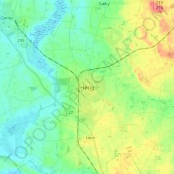
Name: Høng topographic map, elevation, terrain.
Location: Høng, Kalundborg Kommune, Region Sjælland, 4270, Danemark (55.48847 11.27276 55.52847 11.31276)
Average elevation: 22 m
Minimum elevation: -1 m
Maximum elevation: 42 m
Thank you for supporting this site ❤️
Make a donation
Make a donation