
Jüterbog topographic map
Interactive map
Click on the map to display elevation.
About this map
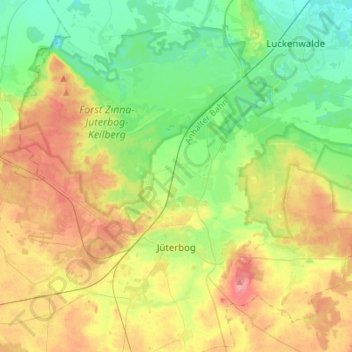
Name: Jüterbog topographic map, elevation, terrain.
Location: Jüterbog, Teltow-Fläming, Brandenburg, 14913, Deutschland (51.95491 12.95605 52.09603 13.23310)
Average elevation: 77 m
Minimum elevation: 41 m
Maximum elevation: 133 m