
Thank you for supporting this site ❤️
Make a donation
Make a donation
Sinpung-dong topographic map
Click on the map to display elevation.
Thank you for supporting this site ❤️
Make a donation
Make a donation
About this map
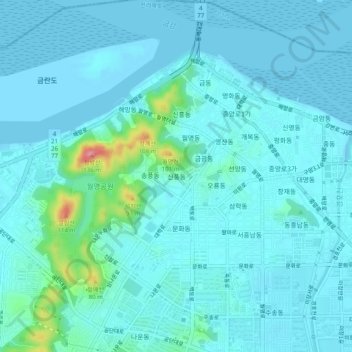
Name: Sinpung-dong topographic map, elevation, terrain.
Location: Sinpung-dong, Gunsan-si, Jeollabuk-do, 54122, South Korea (35.95999 126.68350 35.99999 126.72350)
Average elevation: 14 m
Minimum elevation: -1 m
Maximum elevation: 120 m
Thank you for supporting this site ❤️
Make a donation
Make a donation