Harshi topographic map
Interactive map
Click on the map to display elevation.
About this map
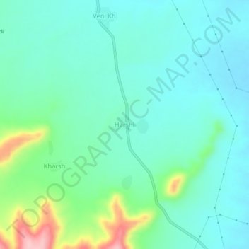
Name: Harshi topographic map, elevation, terrain.
Location: Harshi, Pusad, Yavatmal District, Maharashtra, India (19.79491 77.56972 19.83491 77.60972)
Average elevation: 373 m
Minimum elevation: 333 m
Maximum elevation: 510 m
Other topographic maps
Click on a map to view its topography, its elevation and its terrain.
Nagwadi
India > Maharashtra > Pusad
Nagwadi, Pusad, Yavatmal District, Maharashtra, India
Average elevation: 427 m
Dahiwad
India > Maharashtra > Pusad
Dahiwad, Pusad, Yavatmal District, Maharashtra, India
Average elevation: 329 m
Asoli
India > Maharashtra > Pusad
Asoli, Pusad, Yavatmal District, Maharashtra, India
Average elevation: 336 m
Shilona
India > Maharashtra > Pusad
Shilona, Pusad, Yavatmal District, Maharashtra, India
Average elevation: 374 m
Bibi
India > Maharashtra > Pusad
Bibi, Pusad, Yavatmal District, Maharashtra, India
Average elevation: 417 m
Kharshi
India > Maharashtra > Pusad
Kharshi, Pusad, Yavatmal, Maharashtra, India
Average elevation: 405 m
Panhala
India > Maharashtra > Pusad
Panhala, Pusad, Yavatmal, Maharashtra, India
Average elevation: 541 m