
Thank you for supporting this site ❤️
Make a donation
Make a donation
Protem topographic map
Click on the map to display elevation.
Thank you for supporting this site ❤️
Make a donation
Make a donation
About this map
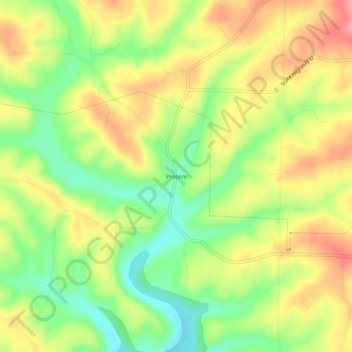
Name: Protem topographic map, elevation, terrain.
Location: Protem, Taney County, Missouri, 65733, United States (36.50895 -92.87878 36.54895 -92.83878)
Average elevation: 244 m
Minimum elevation: 195 m
Maximum elevation: 291 m
Thank you for supporting this site ❤️
Make a donation
Make a donation
Other topographic maps
Click on a map to view its topography, its elevation and its terrain.