
Thank you for supporting this site ❤️
Make a donation
Make a donation
San Andrés topographic map
Click on the map to display elevation.
Thank you for supporting this site ❤️
Make a donation
Make a donation
About this map
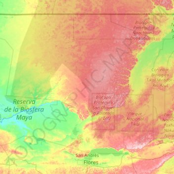
Name: San Andrés topographic map, elevation, terrain.
Location: San Andrés, Petén, Guatemala (16.94225 -90.98772 17.81659 -89.89771)
Average elevation: 206 m
Minimum elevation: 40 m
Maximum elevation: 453 m
Thank you for supporting this site ❤️
Make a donation
Make a donation