
Thank you for supporting this site ❤️
Make a donation
Make a donation
Kharun River topographic map
Click on the map to display elevation.
Thank you for supporting this site ❤️
Make a donation
Make a donation
About this map
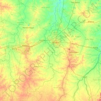
Name: Kharun River topographic map, elevation, terrain.
Location: Kharun River, Patan Tahsil, Durg, Chhattisgarh, India (20.77717 81.43134 21.56844 81.66942)
Average elevation: 292 m
Minimum elevation: 254 m
Maximum elevation: 364 m
Thank you for supporting this site ❤️
Make a donation
Make a donation
Other topographic maps
Click on a map to view its topography, its elevation and its terrain.