
Kindersley No. 290 topographic map
Interactive map
Click on the map to display elevation.
About this map
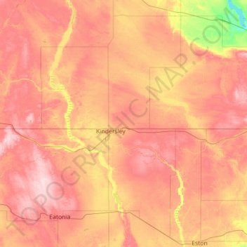
Name: Kindersley No. 290 topographic map, elevation, terrain.
Location: Kindersley No. 290, Division No. 13, Saskatchewan, Canadá (51.35816 -109.66069 51.62019 -108.53502)
Average elevation: 697 m
Minimum elevation: 594 m
Maximum elevation: 785 m