
Thank you for supporting this site ❤️
Make a donation
Make a donation
Kiwale topographic map
Click on the map to display elevation.
Thank you for supporting this site ❤️
Make a donation
Make a donation
About this map
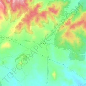
Name: Kiwale topographic map, elevation, terrain.
Location: Kiwale, Khed, Pune District, Maharashtra, India (18.82968 73.78345 18.86968 73.82345)
Average elevation: 673 m
Minimum elevation: 618 m
Maximum elevation: 757 m
Thank you for supporting this site ❤️
Make a donation
Make a donation
Other topographic maps
Click on a map to view its topography, its elevation and its terrain.