
Thank you for supporting this site ❤️
Make a donation
Make a donation
Plano topographic map
Click on the map to display elevation.
Thank you for supporting this site ❤️
Make a donation
Make a donation
About this map
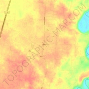
Name: Plano topographic map, elevation, terrain.
Location: Plano, Warren County, Kentucky, 42102, United States (36.86032 -86.43832 36.90032 -86.39832)
Average elevation: 182 m
Minimum elevation: 140 m
Maximum elevation: 197 m
Thank you for supporting this site ❤️
Make a donation
Make a donation
Other topographic maps
Click on a map to view its topography, its elevation and its terrain.