
Kohat topographic map
Interactive map
Click on the map to display elevation.
About this map
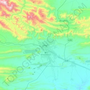
Name: Kohat topographic map, elevation, terrain.
Location: Kohat, Kohāt District, Khyber Pakhtunkhwa, Pakistan (33.43671 71.27999 33.75671 71.59999)
Average elevation: 722 m
Minimum elevation: 369 m
Maximum elevation: 2,162 m