
Gryon topographic map
Interactive map
Click on the map to display elevation.
About this map
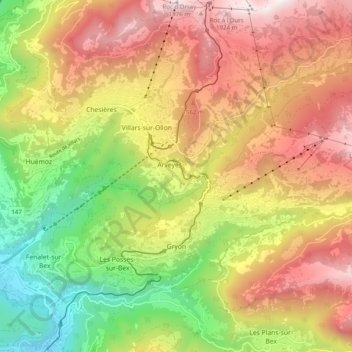
Name: Gryon topographic map, elevation, terrain.
Location: Gryon, District d'Aigle, Vaud, 1882, Svizzera (46.26606 7.05242 46.31035 7.15140)
Average elevation: 1,240 m
Minimum elevation: 457 m
Maximum elevation: 2,014 m