
Thank you for supporting this site ❤️
Make a donation
Make a donation
West Richland topographic map
Click on the map to display elevation.
Thank you for supporting this site ❤️
Make a donation
Make a donation
West Richland
The original people of the region were the Chemnapum Indians (closely related to the Wanapum tribe), living near the mouth of the Yakima River. Lewis and Clark passed through the area in 1805, and an expedition of the Army Corps of Topographical Engineers headed by Robert E Johnson mapped the Yakima Valley in 1841.
Thank you for supporting this site ❤️
Make a donation
Make a donation
About this map
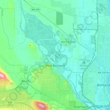
Name: West Richland topographic map, elevation, terrain.
Average elevation: 146 m
Minimum elevation: 93 m
Maximum elevation: 424 m
Thank you for supporting this site ❤️
Make a donation
Make a donation
Other topographic maps
Click on a map to view its topography, its elevation and its terrain.