Geolocate

Gers topographic map

Interactive map

Click on the map to display elevation.

About this map

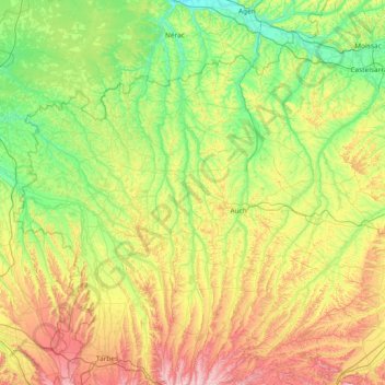
Name: Gers topographic map, elevation, terrain.

Location: Gers, Occitania, Metropolitan France, France (43.31084 -0.28243 44.08001 1.20327)

Average elevation: 194 m

Minimum elevation: 34 m

Maximum elevation: 609 m

Other topographic maps

Click on a map to view its topography, its elevation and its terrain.

Thoux

France > Occitania > Gers

Thoux, Condom, Gers, Occitania, Metropolitan France, 32430, France

Average elevation: 181 m

Eauze

France > Occitania > Gers > Eauze

Eauze, Condom, Gers, Occitania, Metropolitan France, 32800, France

Average elevation: 153 m

Sion

France > Occitania > Gers

Sion, Condom, Gers, Occitania, Metropolitan France, 32110, France

Average elevation: 124 m