
Shannon County topographic map
Interactive map
Click on the map to display elevation.
About this map
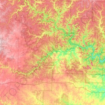
Name: Shannon County topographic map, elevation, terrain.
Location: Shannon County, Missouri, Vereinigte Staaten von Amerika (36.88383 -91.65770 37.42264 -91.01686)
Average elevation: 308 m
Minimum elevation: 155 m
Maximum elevation: 444 m
Other topographic maps
Click on a map to view its topography, its elevation and its terrain.
Lewis County
Vereinigte Staaten von Amerika > Missouri
Lewis County, Missouri, Vereinigte Staaten von Amerika
Average elevation: 189 m
Norvey Creek
Vereinigte Staaten von Amerika > Missouri > Nodaway County
Norvey Creek, Nodaway County, Missouri, 64476, Vereinigte Staaten von Amerika
Average elevation: 343 m
Iron County
Vereinigte Staaten von Amerika > Missouri
Iron County, Missouri, Vereinigte Staaten von Amerika
Average elevation: 292 m