
Capilla central topographic map
Interactive map
Click on the map to display elevation.
About this map
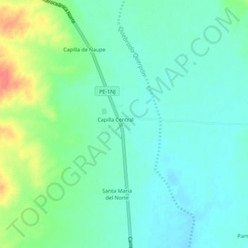
Name: Capilla central topographic map, elevation, terrain.
Location: Capilla central, Provincia de Lambayeque, Lambayeque, Perú (-5.65046 -79.90266 -5.61046 -79.86266)
Average elevation: 160 m
Minimum elevation: 143 m
Maximum elevation: 203 m