
Gáldar topographic map
Interactive map
Click on the map to display elevation.
About this map
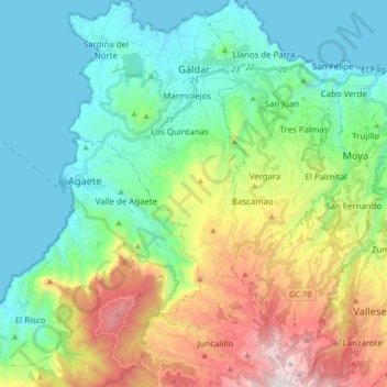
Name: Gáldar topographic map, elevation, terrain.
Location: Gáldar, Las Palmas, Kanarische Inseln, 35460, Spanien (28.01942 -15.70970 28.17096 -15.61387)
Average elevation: 501 m
Minimum elevation: 0 m
Maximum elevation: 1,751 m
Other topographic maps
Click on a map to view its topography, its elevation and its terrain.