
Whitestone topographic map
Interactive map
Click on the map to display elevation.
About this map
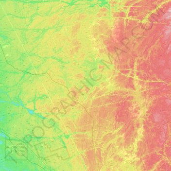
Name: Whitestone topographic map, elevation, terrain.
Average elevation: 249 m
Minimum elevation: 177 m
Maximum elevation: 341 m
Other topographic maps
Click on a map to view its topography, its elevation and its terrain.
Ellsmere Island
Canada > Ontario > Parry Sound District > The Archipelago Township
Ellsmere Island, The Archipelago Township, Parry Sound District, Central Ontario, Ontario, Canada
Average elevation: 197 m
Novar
Canada > Ontario > Parry Sound District > Perry Township
Novar, Perry Township, Parry Sound District, Central Ontario, Ontario, P0A 1R0, Canada
Average elevation: 348 m
Doe Lake
Canada > Ontario > Parry Sound District > Ryerson Township
Doe Lake, Ryerson Township, Parry Sound District, Central Ontario, Ontario, Canada
Average elevation: 311 m
McKellar
Canada > Ontario > Parry Sound District > McKellar Township
McKellar, McKellar Township, Parry Sound District, Central Ontario, Ontario, P0G 1C0, Canada
Average elevation: 250 m
Carson Bay
Canada > Ontario > Parry Sound District > The Archipelago Township
Carson Bay, The Archipelago Township, Parry Sound District, Central Ontario, Ontario, Canada
Average elevation: 187 m
Seguin Township
Canada > Ontario > Parry Sound District
Seguin Township, Parry Sound District, Central Ontario, Ontario, Canada
Average elevation: 247 m
Parry Sound
Canada > Ontario > Parry Sound District > Parry Sound
Parry Sound, Parry Sound District, Central Ontario, Ontario, P2A 1B2, Canada
Average elevation: 202 m
Island Lake
Canada > Ontario > Parry Sound District
Island Lake, Parry Sound District, Central Ontario, Ontario, Canada
Average elevation: 223 m
Emsdale
Canada > Ontario > Parry Sound District > Perry Township > Emsdale
Emsdale, Perry Township, Parry Sound District, Central Ontario, Ontario, P0A 1J0, Canada
Average elevation: 349 m