
Kaipara District topographic map
Interactive map
Click on the map to display elevation.
About this map
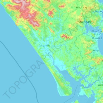
Name: Kaipara District topographic map, elevation, terrain.
Location: Kaipara District, Northland, New Zealand (-36.39683 173.47713 -35.59458 174.61697)
Average elevation: 68 m
Minimum elevation: -2 m
Maximum elevation: 754 m