
Gschnaidt topographic map
Interactive map
Click on the map to display elevation.
About this map
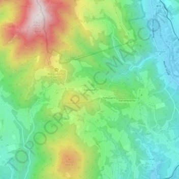
Name: Gschnaidt topographic map, elevation, terrain.
Location: Gschnaidt, Anger, Bezirk Weiz, Steiermark, 8184, Österreich (47.24589 15.64678 47.28589 15.68678)
Average elevation: 736 m
Minimum elevation: 461 m
Maximum elevation: 1,257 m