
Chantaco topographic map
Interactive map
Click on the map to display elevation.
About this map
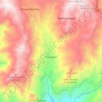
Name: Chantaco topographic map, elevation, terrain.
Location: Chantaco, Loja, Ecuador (-3.91177 -79.35236 -3.83655 -79.28544)
Average elevation: 2,571 m
Minimum elevation: 1,742 m
Maximum elevation: 3,140 m