
Timmersdorf topographic map
Interactive map
Click on the map to display elevation.
About this map
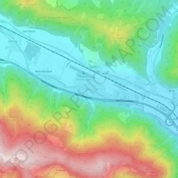
Name: Timmersdorf topographic map, elevation, terrain.
Average elevation: 805 m
Minimum elevation: 604 m
Maximum elevation: 1,175 m
Other topographic maps
Click on a map to view its topography, its elevation and its terrain.
Trofaiach
Österreich > Steiermark > Bezirk Leoben > Trofaiach
Trofaiach, Bezirk Leoben, Steiermark, 8793, Österreich
Average elevation: 1,066 m
Vordernberg
Österreich > Steiermark > Bezirk Leoben > Vordernberg
Vordernberg, Bezirk Leoben, Steiermark, 8794, Österreich
Average elevation: 1,284 m