
Dryden topographic map
Interactive map
Click on the map to display elevation.
About this map
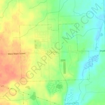
Name: Dryden topographic map, elevation, terrain.
Average elevation: 281 m
Minimum elevation: 258 m
Maximum elevation: 303 m
Other topographic maps
Click on a map to view its topography, its elevation and its terrain.
Hadley
United States > Michigan > Lapeer County
Hadley, Hadley Township, Lapeer County, Michigan, 48440, United States
Average elevation: 274 m
Lapeer Township
United States > Michigan > Lapeer County
Lapeer Township, Lapeer County, Michigan, United States
Average elevation: 266 m