
Aldehuela topographic map
Interactive map
Click on the map to display elevation.
About this map
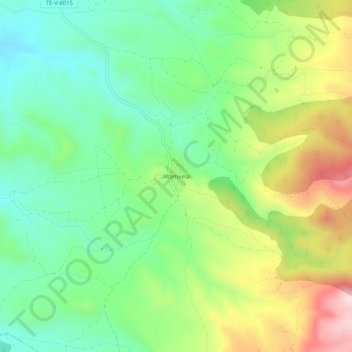
Name: Aldehuela topographic map, elevation, terrain.
Location: Aldehuela, Teruel, Comunidad de Teruel, Teruel, Aragón, España (40.24749 -1.07843 40.28749 -1.03843)
Average elevation: 1,083 m
Minimum elevation: 943 m
Maximum elevation: 1,328 m