
Kanjar topographic map
Interactive map
Click on the map to display elevation.
About this map
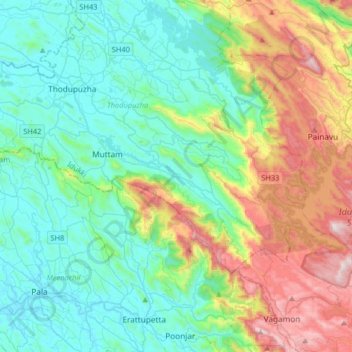
Name: Kanjar topographic map, elevation, terrain.
Location: Kanjar, Idukki, Kerala, 685590, India (9.77787 76.76978 9.85787 76.84978)
Average elevation: 282 m
Minimum elevation: 37 m
Maximum elevation: 1,021 m