
Zschopau topographic map
Interactive map
Click on the map to display elevation.
About this map
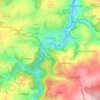
Name: Zschopau topographic map, elevation, terrain.
Location: Zschopau, Erzgebirgskreis, Sachsen, Deutschland (50.71566 13.03633 50.76385 13.13143)
Average elevation: 450 m
Minimum elevation: 308 m
Maximum elevation: 633 m