
Sharur District topographic map
Interactive map
Click on the map to display elevation.
About this map
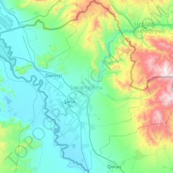
Name: Sharur District topographic map, elevation, terrain.
Location: Sharur District, Nakhichevan, Azerbaijan (39.38497 44.80938 39.79438 45.34223)
Average elevation: 1,178 m
Minimum elevation: 780 m
Maximum elevation: 2,769 m