
Kalewadi topographic map
Interactive map
Click on the map to display elevation.
About this map
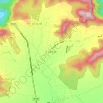
Name: Kalewadi topographic map, elevation, terrain.
Location: Kalewadi, Purandhar, Pune, Maharashtra, India (18.38436 74.00144 18.42436 74.04144)
Average elevation: 839 m
Minimum elevation: 677 m
Maximum elevation: 984 m
Other topographic maps
Click on a map to view its topography, its elevation and its terrain.