
Sarnersee topographic map
Interactive map
Click on the map to display elevation.
About this map
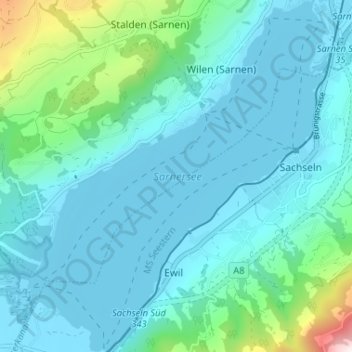
Name: Sarnersee topographic map, elevation, terrain.
Location: Sarnersee, Seeweg, Sachseln, Obwalden, 6072, Schweiz (46.84551 8.18883 46.88988 8.24398)
Average elevation: 601 m
Minimum elevation: 467 m
Maximum elevation: 1,379 m
Der Sarnersee ist ein 7,5 km² grosser See in der Zentralschweiz im Kanton Obwalden. Er erstreckt sich in Südwest-Nordost-Richtung, ist ungefähr 6 km lang und hat eine mittlere Breite von 1,3 km. Die mittlere Seehöhe liegt auf 469 m ü. M., der tiefste Punkt des Seegrundes auf 418 m ü. M., was einer maximalen Tiefe von 51 m entspricht.