
Thank you for supporting this site ❤️
Make a donation
Make a donation
Kandhi topographic map
Click on the map to display elevation.
Thank you for supporting this site ❤️
Make a donation
Make a donation
About this map
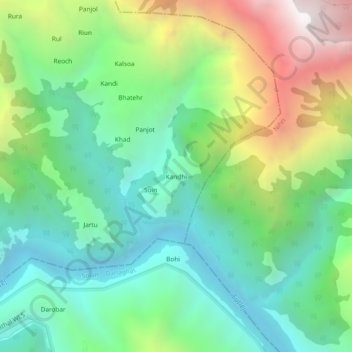
Name: Kandhi topographic map, elevation, terrain.
Location: Kandhi, Sundarnagar, Mandi, Himachal Pradesh, India (31.35227 76.90020 31.39227 76.94020)
Average elevation: 1,122 m
Minimum elevation: 533 m
Maximum elevation: 2,345 m
Thank you for supporting this site ❤️
Make a donation
Make a donation
Other topographic maps
Click on a map to view its topography, its elevation and its terrain.